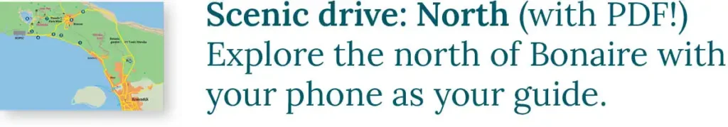
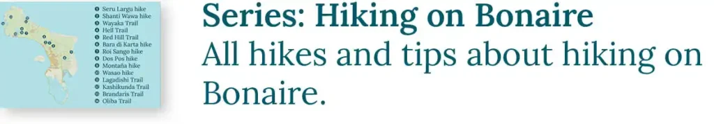
One of our favorite activities in Bonaire is taking the two scenic drives. This blog is about the Scenic Drive to the Salt Pans in the south of Bonaire, locally known as the “Rondje Zuid” (the South Loop). The other drive is the Scenic Drive to the North. When you say you’re going to do a “Rondje Zuid”, everyone immediately knows what you mean. There is much to see and experience on this scenic drive, and you can simply explore it with your own rental car, scooter, or golf cart.
Sharing Island Love
Thank you for your interest in our beautiful island in the Caribbean! We love sharing our passion for Bonaire with everyone — locals, visitors, and of course, with our guests during Our tours. Curious how we do that? You can find all the details in Sharing Island Love.
With Island Love,![]()
Are you eager for more scenic wonders to explore? Then our tours are perfect for you.
Onderwerpen
- 1 Te Amo Beach (1)
- 2 Donkey Beach (2)
- 3 Belnem (3)
- 4 Trans World Radio (4)
- 5 Graf di Portugues (5)
- 6 The Salt Pier (6)
- 7 The Blue Obelisk (7)
- 8 Pink Beach (8)
- 9 White Slave Huts (9)
- 10 Atlantis Beach or Kite Beach (10)
- 11 Red Slave Huts (11)
- 12 Pekelmeer Flamingo Sanctuary (12)
- 13 The Willemstoren (13)
- 14 Shete Kolo (14)
- 15 The Old Shrimp Factory (15)
- 16 Sorobon (16)
- 17 The Mangrove (17)
- 18 About us: A Tour with HopiBonaire
- 19 Read more?
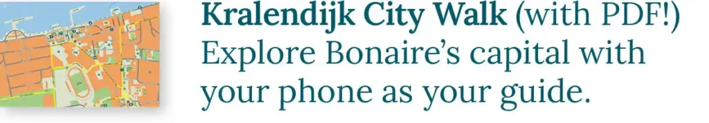
Get to know HopiBonaire for free. Download this blog as a PDF and let your phone guide you:

You can do this Scenic Drive in two directions. Here, we will discuss it counterclockwise, but if you, for example, want to start with a brunch at Sorobon (16), you can also drive the route the other way around. We start at Bonaire’s airport and drive south on Kaya International towards the EEG Boulevard.
Te Amo Beach (1)
Opposite the fuel storage facility of the airport, you find Te Amo Beach, one of the few sandy beaches on Bonaire. This beach is very popular and has a large parking area. The sandy bottom attracts unique fish like the peacock flounder. Can you spot them?

Donkey Beach (2)
If you want more shade, head to the adjacent Donkey Beach. This beach is located behind the runway of Flamingo Airport. The tree-lined shore offers plenty of nice shady spots. If you’re lucky, a landing plane might just fly overhead. Cover your ears!

Belnem (3)
From Donkey Beach, drive south towards the Belnem neighbourhood. Just after the first major side street (Kaya IR Randolph Statius van Eps), you will find the parking lot for Bachelor’s Beach on the right side of the road. This picturesque sandy beach, officially called Fòrni Kalki, is nestled at the bottom of a modest cliff and is a favorite spot among locals.
In Belnem, you find two charming beach clubs. The Grand Windsock Ocean Club (formerly known as The Beach) is a cozy, centrally located club with steps leading into the refreshing water. Ocean Oasis is much further south and is a larger beach club with a spacious beach area. Next to this beach club is the unfinished Hotel Esmeralda, now a popular spot for muralists who leave behind beautiful street art in the rooms and galleries.
Local Stories
Bonaire is brimming with fascinating local stories. The Belnem district was founded on the initiative of Harry Belafonte (an American singer and actor) and his friend Maurice Neme. It is said that they frequently visited Bonaire, often accompanied by James Bond actor Roger Moore. Belafonte’s worldwide hit “Island in the Sun” is even rumored to be about Bonaire! However, the truth is that Belafonte visited Bonaire only once (indeed with Roger Moore!), and that was many years after he scored his hit.
Another persistent rumor involves Hotel Esmeralda, allegedly built by none other than the notorious drug lord Pablo Escobar. Although Escobar owned several properties in the Caribbean, there is no evidence to support his supposed activities on Bonaire. Yet, this story continues to resurface!
Are you a fan of such local tales? During our tours, we are delighted to share them with you!
Trans World Radio (4)
As you continue south, you leave the buildings of Kralendijk behind. On the right side of the road, you will see the four large transmission towers of Trans World Radio. With these towers, TWR broadcasts Christian radio programs that can be received from Cuba to Brazil!
Graf di Portugues (5)
Just before the parking lot of the Salt Pier lies the Graf di Portugues (Portuguese Grave). It is over 200 years old, making it the oldest grave on Bonaire. The story goes that it is the final resting place of a Portuguese sailor who couldn’t afford a plot in one of the official cemeteries. Local fishermen claim to hear Portuguese voices whispering there at night. In reality, it is the grave of a Dutch slave overseer from the 18th century.

The Salt Pier (6)
The southern part of Bonaire is largely dedicated to salt production. If all goes well, you saw them appearing on the horizon a while ago: the salt pyramids. These piles are waiting here for export. The salt in these began in the strange pink lakes you drove past. As the water in these lakes evaporates, the salt concentration increases. In this salty environment, almost nothing can survive. A red-colored alga dominates here, causing the unique color of the water.

Over time, the salt crystallizes on the bottom and is ready to be harvested. Then, the salt is loaded into the hold of a seafaring vessel via the Salt Pier (Zoutpier in Dutch). Each year, half a million kilotons (one billion pounds) of salt leave the island this way! Most of the salt is transported to America, where it is processed into road salt or dishwasher salt. Do you want to take a closer look at the salt? There is a container by the ruins opposite the entrance gate of Cargill. You can find it immediately to your right after driving under the pier.
Snorkeling at the Salt Pier
Snorkeling is a favorite activity on Bonaire, and the Salt Pier is one of the beloved snorkeling spots. However, you are only allowed to enter the water when no ship is docked. At this spot, you almost always encounter grazing Sea Turtles on the seafloor. If you are in good condition, you can swim to the end of the pier. Here, the pier’s pillars disappear into the depths, creating a surreal sight! Take your time to swim back to the beach, especially if there’s a strong current! Snorkeling can be dangerous and is at your own risk.

Our seven snorkeling commandments: • We use reef-friendly sunscreen. • We enter the water at the yellow entry/exit rock. • In the water, we stay horizontal: minimizing standing, and never stepping on corals. • We don’t touch anything. Even a light touch can harm the coral. • We don’t take anything out of the water unless it’s plastic waste. • We don’t feed the fish. • We respect the reef, so we pay our STINAPA Nature Fee. |
Note: If Cargill is loading a ship at the Salt Pier, you are not allowed to enter the water! If you don’t want any unpleasant surprises, you can check that on the Portcall site. The Salt Pier is indicated as “Cargill” there. (The South Pier, also mentioned, is located in Kralendijk).
The Blue Obelisk (7)
For centuries, salt has been loaded onto ships at this location. The Blue Obelisk testifies to this history, though its ten-meter height is dwarfed by the massive pier. This beacon marked the spot where ships could load salt during The time when Bonaire was a Government Plantation.
The Blue Obelisk stood on the beach at Blue Pan. Further along, you will encounter a white, red, and orange obelisk. The color system was introduced in 1838. Before that, Blue Pan was known as Saliña Abou.
Pink Beach (8)
From the blue obelisk, you can already spot the palm trees of Pink Beach in the distance. On your way to this beach, you likely encounter the first flamingos to the left of the road. They are searching for their food, brine shrimp, in the shallow waters. As the shrimp consume the red algae from the lake, they contribute to the birds’ unique color. Don’t forget to keep an eye out for other water birds and herons in this area as well.
Once you reach the sandy shores of Pink Beach, it’s delightful to relax. Choose a palm tree and find peace in the shade or lay your towel on the lower sandy beach area.

White Slave Huts (9)
After Pink Beach, the road turns eastward. Right after this bend lies the White Pan (before 1838: Kabayé), marked by the White Obelisk. Here, you will find the White Slave Huts from 1850, which serve as reminders of the slavery era.
Between 1636 and 1863, enslaved individuals and prisoners were forced to work here under inhumane conditions. They endured long days and performed arduous tasks. The corrosive salt damaged their hands and feet, and the reflection of the white crystals caused vision problems, leading to blindness. The slaves spent their nights in the open air or in small huts made of palm leaves, with their wet clothes on. The salt pans of Bonaire were thus called The White Hell.
The stone huts were built only thirteen years before the abolition of slavery. During that time, there was increasing criticism towards slavery. On the Dutch island of Sint Maarten, slavery had already come to an end, initiated by France. Presumably, the huts were erected here to convey the impression that the enslaved individuals on Bonaire were treated well. The fact that far too few huts were constructed to accommodate the more than 200 slaves supports that suspicion.
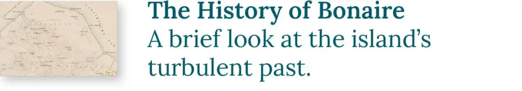
Interested in history? Take a dive into The History of Bonaire.
Atlantis Beach or Kite Beach (10)
In the far south of the island, we find more slave huts. On the way, you pass Atlantis Beach. In this part of Bonaire, the usually strong easterly wind has free rein. Many kitesurfers take advantage of the wind here. That’s why Atlantis is also called Kite Beach. Pull over for a moment to enjoy the impressive aerial acrobatics!

In this area, you can often spot pelicans. They rest on the rocks along the beach or float on the water. When they get hungry, they go hunting, which is a spectacular sight! They plunge into the water with a big splash to catch their prey.
Due to the kitesurfers, it’s too dangerous to enter the water at Atlantis. A little further on is Vista Blue Beach, where it’s much safer to swim.
Red Slave Huts (11)
The Red Slave Huts stand on both sides of the road. They are actually ochre yellow and are located near the orange obelisk at the Orange Pan (before 1838: Sedesuk). By the way, did you see the red obelisk along the way? The Red Pan (before 1838: Peleké) is right next to the Orange Pan. You can see the red obelisk a bit further back.

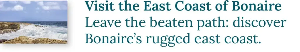
At this location, the character of the sea changes. The tranquil west coast sheltered by the island transforms into the rugged east coast. When the wind is weak, you can snorkel beautifully in a westerly direction (!) here. We often see rays on the sandy seabed. However, do not enter the water during normal wind conditions as the currents can be extremely treacherous! Snorkeling can be dangerous and is at your own risk.
Pekelmeer Flamingo Sanctuary (12)
On the other side of the road is the Pekelmeer Flamingo Sanctuary. Pekelmeer is Dutch for brine lake. Here, flamingos search for food. A few kilometers inland is their breeding colony. In the Flamingo Sanctuary, they can raise their young in peace. You can read more about it in our flamingo photo blog. Bonaire is therefore an important island for flamingos. Only a few other places offer these birds such favorable conditions for nesting.

The Willemstoren (13)
The road slowly bends back towards the north. Along the way, on Punt Lacre, stands the Willemstoren (Torn’i Sùit in Papiamentu), a 21 meter (70 feet) high lighthouse dating back to 1838. The tower is named after King Willem I and was first lit on his birthday, August 24th. At that time, a lighthouse keeper was needed, and the light burned on paraffin oil. Nowadays, the tower is fully automated and runs on solar energy. The lighthouse keeper’s house, located next to the tower, is now a ruin.

Shete Kolo (14)
Drive about five kilometers (3 miles) further from the Willemstoren. There, on the coast, you will find another obelisk. Before the construction of the lighthouse, the low southern part of the island was barely visible to ships at night. During calm weather, a particular sound alerted the crew to the presence of land. The waves washing over the pieces of coral on the beach created a tingling sound. However, during storms, this warning was lost amid the howling of the wind, resulting in many ships running aground on this part of the coast.
After a storm, the residents of Bonaire would come in groups to this section of the east coast to rescue the shipwrecked crew and salvage the cargo. To prevent disputes, each group placed a colored flag on the beach. The loot was left near the flag, making it clear to everyone who the new owners were. There were a total of seven groups, each with their own colored flag. This is why this coast is called Shete Kolo (Seven Colors).
Due to the strong east wind, these beaches receive a lot of driftwood and debris. Behind Shete Kolo, the coast is adorned with artworks created from this washed-up material.

The Old Shrimp Factory (15)
On Bonaire, you can find a lot of beautiful street art, especially near the remains of the shrimp factory. You will encounter it two kilometers (a mile) further down the road, on the right side. From the road, you can already see several remarkable artworks, such as Its gonna be oke, Enjoy the little things, and the Bonalisa (inspired by the Mona Lisa). Inside the complex, there are several other exceptional murals.

Amor stands somewhat secluded, close to the sea.
Sorobon (16)
Right after the factory, you will encounter the first turnoff in 20 kilometers (12 miles). It’s the turnoff to Sorobon, a peninsula in Lac Bay. This shallow bay with its calm waters is perfectly suited for windsurfers. The laid-back vibe that comes with surfing is abundant here. Enjoy the azure blue water at one of the beach bars. At the end of the peninsula, you’ll find a lookout tower with stunning views over the waters of Lac. A little further on, there’s a small harbor.

Leave the peninsula in the opposite direction and turn right to continue driving. If you keep going straight, you will end up back in Belnem (3). Along the way, you’ve probably seen many wild donkeys. If you still can’t get enough of these animals, you can visit the Donkey Sanctuary on your way to Belnem. There, over 800 donkeys are kept.
The Mangrove (17)
If you turn right 900 meters (half a mile) after Sorobon, you will head towards the center of Kralendijk. This road winds along the beautiful Mangrove Forests of Bonaire. In the pools along the road, you can spot various water birds, such as herons, flamingos, and smaller wading birds. Feel free to park the car on the roadside to observe them better, but stay inside the car. As soon as you step out, the birds will likely walk or fly away, and the show will be over!

Get to know HopiBonaire for free. Download this blog as a PDF and let your phone guide you:
Wondering what to do on Bonaire? Now you know! The information above is just a fraction of what there is to discover along this route. If you want to know more, we’d be happy to take you on a tour. This scenic drive to the salt pans of Bonaire is part of our Mesmerizing Bonaire island tour. During that tour, we explore the four corners of Bonaire with you in one afternoon!
Are you also interested in exploring the North of Bonaire? Read our Scenic drive to the North of Bonaire blog. Just like this drive, you drive it with your own rental car, scooter, or golf cart.
About us: A Tour with HopiBonaire
During our tours, you will embark on a exploration to the most remote and beautiful spots on the island. You will be traveling only with your own group, ensuring an intimate and personalized experience at your own pace. We don’t rush!
All tours can be customized to your preferences, and there is the possibility to book fully personalized tours. Have you become excited and eager to join the adventure? Check out the selection of our tours.
Read more?