
The capital (and only city) of Bonaire is Kralendijk. In the center of Kralendijk, also known as Playa, there is a lot to see. Join us on a city walk along the highlights of Kralendijk, where we share fascinating background stories along the way.
Sharing Island Love
Thank you for your interest in our beautiful island in the Caribbean! We love sharing our passion for Bonaire with everyone — locals, visitors, and of course, with our guests during Our tours. Curious how we do that? You can find all the details in Sharing Island Love.
With Island Love,![]()
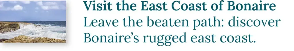
Away from the city crowds? Escape the masses with our tours exploring the hidden gems of Bonaire.
Onderwerpen
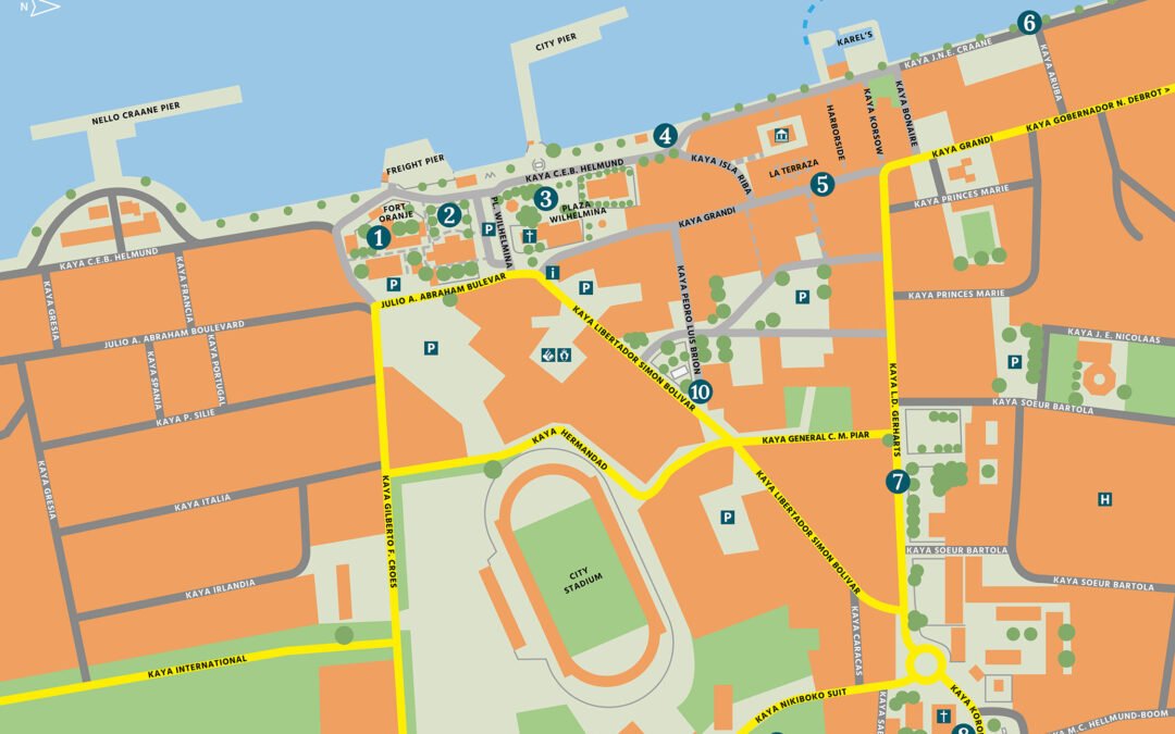
- 1 A Piece of History
- 2 The First Fort
- 3 The Emergence of Kralendijk
- 4 Fort Oranje (1)
- 5 The Commander’s Residence (2)
- 6 Plaza Wilhelmina (3)
- 7 Plasa Machi Mimi (4)
- 8 Kaya Grandi (5)
- 9 The Boulevard (6)
- 10 The Old Hospital and the St. Francis Monastery (7)
- 11 Plasa Fraternan di Tilburg and the St. Bernardus Church (8)
- 12 The Bonaire Museum/The Van der Ree House (9)
- 13 The Simón Bolívar Monument (10)
- 14 About us: A Tour With HopiBonaire
- 15 Read more?
Get to know HopiBonaire for free. Download this blog as a PDF and let your phone guide you:

A Piece of History
Before we delve into the highlights, let’s start with a piece of The history of Bonaire. In 1636, Bonaire came under Dutch control when Johannes van Walbeeck of the Dutch West India Company (WIC) captured the island from the Spanish, who had settled in a valley in the north of Bonaire since 1527. This is how Rincon, the only village on Bonaire, was established. Under Dutch rule, Rincon remained the main settlement for a long time. Kralendijk did not exist yet.
The First Fort
Following the conquest, salt production began. Initially, the Caiquetios, the original inhabitants of Bonaire, were put to work on the salt pans. Soon after, the first ships arrived carrying enslaved Africans. During our tours, we delve deeper into this period of history.
To protect the salt, also known as white gold, a small fort was built. The fort was armed with four cannons and manned by about fifty soldiers. In 1792, the WIC went bankrupt, and Bonaire came under the control of the Dutch Government. This marks the beginning of the history of Kralendijk.
The Emergence of Kralendijk
During that time, Bonaire is one large plantation. Unlike Curaçao, free people are not allowed to settle. The WIC enforces this strictly, but under the rule of the Dutch Government, that supervision slackens. In the shelter of Klein-Bonaire, a settlement arises on a beach with a wall of washed-up coral. The inhabitants call this coral (koralen) wall a “dijk” (dike). Thus, “Kralendijk” is born.
However, Rincon remains the largest settlement on Bonaire until 1850. Then, a large part of the enslaved population is required to move closer to the salt pans, giving rise to the village of Pueblo Nobo (new village) near Kralendijk. With the enslaved people no longer having to walk all the way to Rincon and back, they have to work even more hours on the salt pans.

Fort Oranje (1)
Fort Oranje is a good place to start our exploration of the city center of Bonaire’s capital Kralendijk. Behind the fort, there is a large parking area where you can always find a spot.
At the beginning of the nineteenth century, Bonaire briefly falls into English hands. This happens when the English threaten to attack Curaçao. All soldiers from Bonaire are hastily transferred to Curaçao as reinforcements. Bonaire is surrendered without a fight.
In 1816, Bonaire is returned to the Netherlands. Fort Oranje is constructed to enhance the island’s defense. Oranje means orange in Dutch, and it is the surname of the Dutch Royal Family. Emerging Kralendijk thrives under the protection provided by the fort. Behind the 4 meter (13 feet) high walls of Fort Oranje, four cannons stand. When the fort is open, you can get a close look at them. These cannons were left behind by the English. The six cannons from the first fort of the West India Company found a second life here from 1816 when ships were moored to them. Just south of the fort, there is another such remarkable mooring post to see.

The Commander of Bonaire lives in the fort during the first few years. Valuable goods are also stored behind the high walls. Later, the fort serves as a prison, police station, fire station, and museum. Today, it houses the public prosecutor’s office. If the fort is open, you can view the English cannons up close. There is also a stone lighthouse in the fort, built in 1932 to replace a wooden one.
The Commander’s Residence (2)
Since their arrival on Bonaire, the Dutch West India Company (WIC) has been appointing commanders (commandeurs) on the island. Supported by a handful of soldiers, these gentlemen oversee the affairs on Bonaire. After the bankruptcy of the WIC, the Dutch government takes charge of Bonaire. Out of habit, the government continues to refer to their representative on the island as the Commander.
At the beginning of the nineteenth century, the Commander of Bonaire resides in the small residence within the fort. However, there is a need for a more substantial residence for the Commander. In 1837, this impressive building is erected right next to the fort. On the ground floor, goods are stored, and the living area is on the first floor. In front of the Commander’s Residence, there is a beautiful garden.

In 1848, the daily governance of Bonaire is formalized. From then on, the gezaghebber (authority officer) resides in the Commander’s Residence. He is responsible for maintaining peace, order, and safety on the island, and the soldiers are replaced by police officers. The gezaghebber is supported by two elected landsraden (local councils).
The mayor of the Dutch special municipality of Bonaire is still referred to as “gezaghebber” to this day. And Bonaire is still governed, in part, from this building. When the gates on the sides of the garden are open, you can get a close view of this magnificent property.
Plaza Wilhelmina (3)
A little further along, you come across a smaller building right by the coast. This is the Customs Office from 1925. Those who visit Bonaire by ship must report here. Next to the building is the W-shaped Wilhelmina Bench from 1923. This bench was mainly used by people waiting for their loved ones to arrive on the ship.
Across the road you find Plaza Wilhelmina. In the shade of the many trees, a mix of tourists and locals gather here. That’s why the square is also called Wilhelmina Park. It is surrounded by several beautiful buildings.
The Pasanggrahan is the building that catches the eye the most. This majestic property was built in 1890 for the Debrot family. This influential family was politically active and, two years after the construction, purchased the Slagbaai Plantation. They had amassed a significant amount of money, partly from the compensation they received from the Dutch government upon the abolition of slavery. The family owned many enslaved workers, which led to their compensation.
In 1921, the building came under the ownership of the government. It has since served, among other things, as accommodation for traveling officials. Pasanggrahan is the Javanese word for such a building. Nowadays, it is used for meetings by the Island Council, which is the municipal council of Bonaire.

On the east side of the square stands a Protestant Church from 1847. The Cuban restaurant next to it is located in the First School Building of Bonaire. The construction of the school was largely funded by the community. Among others, Aldersina Janga made a significant contribution. This enslaved woman had received three hundred florins to buy her freedom, but she donated the amount so that the school could be realized. In 1849, the first lesson was taught by teacher Willem F. Meinhardt. He lived on the upper floor in the early years.
Additionally, there are two war monuments to be found. The first monument, located in front of the city pier, commemorates the Antillean victims of World War II. In the square itself stands the Eleanor Roosevelt monument. With this plaque, Bonaire commemorates the visit of the First Lady to the American troops on Bonaire in 1944. A notable detail is that Eleanor Roosevelt kept a detailed diary, which does not mention this supposed event. Additionally, there is no other evidence that the First Lady visited the island. This plaque does not change that!

The Van Walbeeck Monument from 1934 also is a plaque. It commemorates the conquest of the Antilles from the Spaniards, which occurred three hundred years ago. For the attentive reader: As mentioned earlier, Bonaire was indeed captured in 1636, but the conquest of the Antilles began two years earlier with Curaçao.
Finally, in the little square next to the Pasanggrahan, there is a Time Capsule from the local Lions Club. The capsule, sealed in 2002, will be opened again in 2042. Alongside a description of Bonaire and various letters to the future, the capsule contains a CD, a calculator, and a mobile phone.
Plasa Machi Mimi (4)

Across from the Pasanggrahan, right by the sea, you will find a small building that most resembles a Greek temple. It is Plasa Machi Mimi, the old fish market. The building dates back to 1935 and is named after Machi Mimi, a beloved fish vendor who was honored in this way after her passing in 1986. Until a few years ago, fruit was traded here by Venezuelan merchants. With their small boats, they bridged the hundred kilometers (60 miles) between Venezuela and Bonaire.
From the fish market, you can walk via Kaya Isla Riba to Kaya Grandi, the main shopping street of Kralendijk and also of Bonaire. Halfway along Kaya Isla Riba, on the left side, you will come across the Terramar Museum. In this museum, you can learn all about The history of Bonaire.

Kaya Grandi (5)
Since old times, Kaya Grandi has been the shopping street of Kralendijk. In the mid-nineteenth century, the families who own various plantations only stay at their country houses during weekends. On weekdays, they live in their elegant buildings in Kralendijk. The children attend school in the city, and other family members work in the shops on the ground floor of the house. The plantations themselves do not yield much wealth. Most of the money is earned through trade.
The Bonairian plantations primarily produce goats, aloe, lime (for building), wood, and charcoal. Only a small portion of these products is sold on the island. Most of it is exported by ship. Families ensure that their ships do not return empty. For the return journey, the cargo holds are filled with sugar, coffee, cornmeal, butter, rice, and spirits. The shops also offer items such as shoes, fabrics, and tools. During our tour in the Washington-Slagbaai Park, we will tell you all about it.

Nowadays, Kaya Grandi is mainly filled with tourists searching for souvenirs. Especially when a cruise ship is in the port, it’s a great spot for people-watching. Don’t forget to walk up to the hidden courtyard near La Terraza and explore Harborside as well. Through this passage, you find yourself back on the boulevard.
The Boulevard (6)
Kaya J.N.E. Craane is the Boulevard of Kralendijk. In the center, it’s often bustling with activity, but outside of it, the boulevard is much calmer. Here, you can leave the hustle and bustle behind and enjoy the floating fishing boats, the parrotfish in the azure blue water, and the noisy laughing gulls. Perhaps a pelican or osprey will fly by!

At various spots along the Kralendijk boulevard, water taxis depart for Klein Bonaire. A visit to this beautiful little island off the coast of Kralendijk is a must. You can read all about it in our blog about Klein Bonaire.

Text continues below…

On the boulevard, you come across the Tului Domacasse Park, among other things. Behind the park, across from Kaya Grandi, you find the beautiful mural Isabel by Tymon de Laat.
The best way to return to the center is by going back the same way. Kaya Grandi can be busy here, and there’s no sidewalk. On Kaya Bonaire, you find yet another mural by Tymon. Leilana was awarded as the best mural worldwide in February 2021!

The Old Hospital and the St. Francis Monastery (7)
The next highlights of Kralendijk can be found further along Kaya L.D. Gerharts.

We start at the Old Hospital. Originally, it was built as the residence of a wealthy Bonairian, but in 1944, it was converted into a hospital. In 1977, the current hospital was constructed behind the old building. Nowadays, the old hospital is used to train nursing staff. At the back of the garden there is a chapel, which if you are lucky will be open.
The hospital shares its garden with the Former St. Francis Monastery. In 1856, the Franciscan Sisters from the Mariadal monastery in Roosendaal established the healthcare services on Bonaire from this Catholic monastery. The hospital still bears the name of St. Francis, and the overarching foundation is named Mariadal.

The facade of the Franciscan Sisters’ monastery is adorned with a beautiful Statue of St. Francis of Assisi. As in any depiction of this saint, St. Francis is wearing a brown habit with a rope tied around his waist. The rope has three knots in total, symbolizing the three vows of the Franciscan Sisters: Poverty, obedience, and purity.The skull at his feet represents impermanence and serves as a reminder that earthly possessions are worthless since they cannot be taken to the afterlife after death.Noticeable are also the wounds on his hands and feet, which he allegedly received while having a vision of Jesus on the cross.

Plasa Fraternan di Tilburg and the St. Bernardus Church (8)
From the Sisters of Roosendaal, we continue our walk to the Brothers of Tilburg. The statue in the form of a monk at Plasa Fraternan di Tilburg commemorates these brothers. Fraternan means brothers in Papiamentu.
At the beginning of the previous century, the monks established two primary schools and a MULO (secondary education) on Bonaire. They gave education on the island a much-needed boost, as the education system was lagging behind the Netherlands, partly due to its history of slavery. The brothers were also active on Curaçao and Aruba.
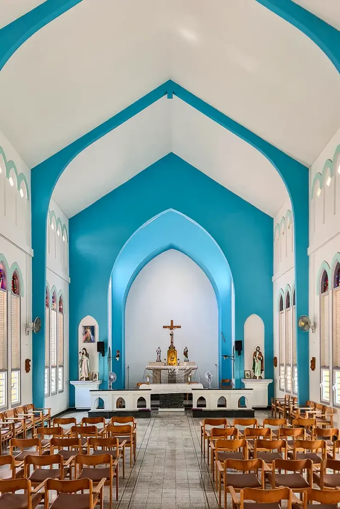
Opposite the square stands the St. Bernardus Church, the largest church in Kralendijk. In 1948, this building replaced the original church from 1829. If you’re lucky, the side doors are open, and you can take a look inside.

The Bonaire Museum/The Van der Ree House (9)
From the church, walk along Kaya Nikiboko Suit. The second street on the left (about 200 meters/yards ahead) is Kaya J.C. van der Ree. At the beginning of that street you will find the Bonaire Museum. This natural history museum is housed in a beautiful building dating back to 1885. The property was owned by the Herrera family, who were the owners of the Slagbaai plantation. The family also used to sell goods from a small shop at their home. The building is also known as the Van der Ree House.

In 1941, Bòy van der Ree becomes the last overseer of Plantation Washington. Under his leadership, there are efforts to invest in the plantation, but it proves to be in vain. The plantations cannot keep up with Bonaire’s post-war development, and profits decline. To make matters worse, Bòy falls ill. In 1966, he expresses the wish to turn his plantation into a nature park. Under these conditions, he offers to sell the land to the government of the Netherlands Antilles. On May 7, 1968, the sale is completed, and Washington becomes the first national park of the Antilles. Unfortunately, Bòy doesn’t live to see this realization. He passes away half a year earlier and is buried on his beloved plantation.
The Simón Bolívar Monument (10)
The next destination is the Simón Bolívar Monument. Coming from the church, you walk via Kaya Libertador Simón Bolívar to the monument. Coming from the museum, you first walk through Kaya Caracas.
In the year 1499, Bonaire was discovered by the Spaniards. They quickly labeled the island as isla inútil, a worthless island, as they didn’t find any significant natural resources here. Eventually, they managed to develop some agricultural activities on the island.
In 1636, Bonaire, along with Curaçao and Aruba, came under Dutch control. The rest of Central America, however, remained under Spanish rule. As a result, the Dutch islands became a refuge for independence fighters who sought to overthrow Spanish dominance.

Simón Bolívar is the most renowned and successful independence fighter from the early nineteenth century. He eventually gained control over large parts of Venezuela, Colombia, Panama, Ecuador, Peru, and Bolivia. Indeed, the latter country is named after him. The monument on Bonaire commemorates his “visit” in 1816. Visit in quotes, because although his ship was in the harbor, he never set foot on land! Four years earlier, he sought refuge on Curaçao after his initial struggle for independence had failed.
From the monument, you walk via Kaya Pedro Luis Brion back to the center of Kralendijk. If you’re wondering who Luis Brion was? He was a Curaçaoan who helped Bolívar during the Venezuelan War of Independence and thus became another hero of the independence struggle.
Get to know HopiBonaire for free. Download this blog as a PDF and let your phone guide you:
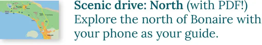
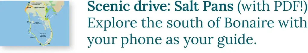
Are you also interested in exploring the rest of Bonaire? Read our Scenic drive to the North of Bonaire blog and the Scenic drive tot the Saltpans of Bonaire blog, or download the PDF’s on your phone. You can drive both routes with your own rental car, scooter, or golf cart. Explore other parts of the island on one of our tours.
About us: A Tour With HopiBonaire
There is also a lot of beauty to be found off the beaten path. Explore the stunning offroad Bonaire with one of our tours. You will be traveling only with your own group, ensuring an intimate and personalized experience at your own pace. We don’t rush!
All our tours can be tailored to your preferences. If you’re excited and eager to join the adventure, check out the offerings of our tours here.
Read more?