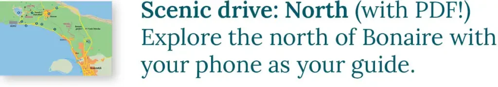
In the northwest of Bonaire lies Playa Frans, a secluded beach on the border of the Washington-Slagbaai National Park. It offers fantastic opportunities for snorkeling and diving, as well as enjoying nature. The enjoyment begins on the journey there. Take a beautiful walk to Saliña Tam, admire the breathtaking sea views, and discover centuries-old rock art by the Caiquetios. Pack your cooler and set out for Playa Frans!
Sharing Island Love
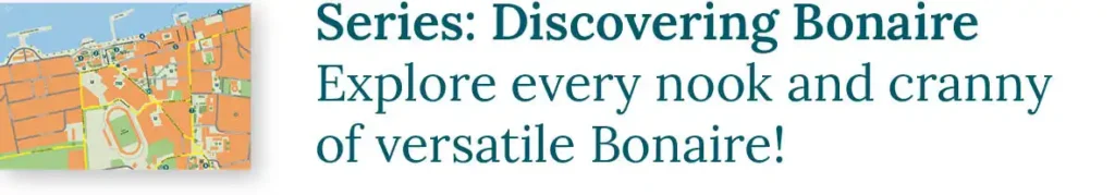
Thank you for your interest in our beautiful island in the Caribbean! We love sharing our passion for Bonaire with everyone — locals, visitors, and of course, with our guests during Our tours. Curious how we do that? You can find all the details in Sharing Island Love.
With Island Love,![]()
Want to visit the island’s hidden gems in addition to the standard tourist attractions? Book a tour with us!
Onderwerpen
- 1 Bird Watching at Lake Goto (1)
- 2 The BOPEC (2)
- 3 Hike to Saliña Tam (3)
- 4 Saliña Tam (4)
- 5 Dive Site Candyland and Tailor Made (5)
- 6 Seaview From Na Kantu (6)
- 7 Druif Rock Art (7)
- 8 Dive Site Nukove (8)
- 9 Playa Frans (9)
- 10 Snorkeling at Playa Frans
- 11 Saliña Frans (10)
- 12 The Reina Maxima Marine Reserve (11)
- 13 The Way Back
- 14 About us: a Tour With HopiBonaire
- 15 Read more?
Bird Watching at Lake Goto (1)
The road to Playa Frans begins here, north of the wide coral barrier between Lake Goto and the Caribbean Sea. A true bird paradise is hidden behind the bushes on the right side of the road. Herons, flamingos, and other water birds peacefully seek their food here, and you can enjoy the spectacle from the vantage points between the bushes! Want to discover more hidden birding locations? Book a Tailor-made Birdwatching Tour with us!

Text continues below…

The BOPEC (2)
To reach Playa Frans, you have to drive past the BOPEC (Bonaire Petroleum Corporation) premises. On the shore of Lake Goto dozens of large tanks stand tall. These storage tanks held oil, and massive oil tankers docked nearby to bring or retrieve the oil, perilously close to the fragile coral reef. Concerns existed even before the construction in 1975, but economic interests outweighed them, as the facility generated many jobs. However, the arrival of BOPEC contributed to the realization among Bonairians that this was not the future for the island. In 1990, the establishment of a refinery was successfully prevented.
In 2010, Bonaire became a special municipality of the Netherlands, bringing stricter environmental laws into effect. In 2017, BOPEC faced further troubles due to sanctions imposed on Venezuela by then-US President Trump. The Venezuelan parent company couldn’t secure the necessary investments. In 2021, BOPEC went bankrupt, but the enormous tanks still mar the landscape. If you turn right before the entrance gate, you find the beginning of the dirt road to Playa Frans. Please don’t be alarmed by the ‘WILDROOSTER’ sign. You won’t be attacked by aggressive roosters along the way. It’s simply the Dutch term for a cattle grid.

Right from the start, you notice that this 7-kilometer (4 miles) dirt road is not in good condition everywhere. The road is riddled with potholes in some sections, and it’s best navigated with a high-clearance vehicle. There are also parts where you can pick up some more speed.
Don’t have a suitable car for the drive to Playa Frans? Book your guided snorkeling tour to Playa Frans here!

The Wasao Hike
At the start of the road to Playa Frans, you find a trail leading to the stunning Wasao viewpoint. Learn all about this hike in our blog The Ten Most Beautiful Hikes on Bonaire. You can also combine your visit to Playa Frans with one of the other nearby trails.
Hike to Saliña Tam (3)
After passing BOPEC, the road curves back towards the coast. Here, a white sign with the text “ENOC PAULINO MELAAN” marks the beginning of a short hike to Saliña Tam. In 300 meters (1000 foot), you walk to one of the shores of this saliña. In the shallow water along the shore, you may encounter many birds, including flamingos.

Saliña Tam (4)
Back on the coast, you drive along the coral barrier of Saliña Tam. Like Lake Goto, this saliña is not directly connected to the sea, which is fortunate! The muddy water from these inland lakes would suffocate the coral. The naturally formed coral reef prevents that. During the rainy season, rainwater collects in the saliña, slowly seeping through the porous coral reef in this location. All sand and other sediment remain behind, allowing crystal-clear water to flow onto the reef. In the dry season, seawater flows into the saliña in the same way, ensuring the saliña never dries up.

Dive Site Candyland and Tailor Made (5)
On the seaside of the coral barrier, you find dive site Candyland. Divers and snorkelers often overlook such secluded spots, which is why the coral remains nearly untouched. Be mindful of the currents when entering the water here!
Our seven snorkeling commandments: • We use reef-friendly sunscreen. • We enter the water at the yellow entry/exit rock. • In the water, we stay horizontal: minimizing standing, and never stepping on corals. • We don’t touch anything. Even a light touch can harm the coral. • We don’t take anything out of the water unless it’s plastic waste. • We don’t feed the fish. • We respect the reef, so we pay our STINAPA Nature Fee. |
Continuing along the beach, you reach dive site Tailor Made. This site is also renowned for its richness in coral. Even if you don’t plan on entering the water, taking this road is a delightful detour. You drive just a few meters from the sea! At the end of the road, it’s easy to turn your car around.

Seaview From Na Kantu (6)
As you ascend from the coral barrier of Saliña Tam, the sea disappears behind the vegetation. Until you reach Playa Frans, the sea only reappears once, but it’s at one of the most beautiful seascapes in Bonaire. At Na Kantu (the edge), you have a magnificent view of the limestone cliffs and the azure blue water. Take a moment to explore the unique holes in the ground at this location. Through these holes, you can witness the waves crashing against the cliff beneath you!

Druif Rock Art (7)
Half a kilometer (one-third of a mile) further lies Boka Druif. In a distant past, the cliff coast partially collapsed here, allowing the water to carve out a boka, or inlet. The road takes a peculiar curve around this inlet. If you want to see Boka Druif, walk into the wide footpath on your left after the curve. After a little over 100 meters (400 feet), you reach Boka Druif.
Opposite the path to Boka Druif (on the right side of the road), you find a narrow trail winding through several columnar cacti. This path leads you to a hidden niche formed in a limestone cliff. Here, you can search for some Rock Art (Marka Indjan in Papiamentu) by the Caiquetios.


The Caiquetios were Amerindians originally from present-day Venezuela. Approximately 1500 years ago, they also settled on Aruba, Curaçao, and Bonaire. When the Spaniards arrived on Bonaire in 1499, it marked an abrupt end to this unique civilization. All that remains are pottery shards and the rock art they left behind. In The History of Bonaire, you learn more about the Caiquetios and the arrival of the Spaniards.
At Druif, the Caiquetios left only a few drawings. They are applied to the ceiling of the niche with red pigments.

Along the stunning East Coast of Bonaire, you can find two rich sites worth exploring. During our tour The Magical North we visit the rock art of Onima, and during the Gems of the East tour you can admire the rock drawings in Cave Spelonk with us. Of course, we extensively reflect on the life of the Caiquetios.
Text continues below…

Dive Site Nukove (8)
Just down the road, you find dive site Nukove (also known as Doblet). This beautiful beach is accessible via a short path on the right side of the road, marked with a yellow stone. Nukove is renowned for its pristine coral and the large fish that inhabit the area.

Playa Frans (9)
And then, after driving 7 kilometers (4 miles) on one of the bumpiest roads in Bonaire, you reach Playa Frans. On this coral barrier of Saliña Frans, you find some fishing huts, used only on weekends. On other days, the fishing boats peacefully float on the azure blue water.


Snorkeling at Playa Frans
After this drive, you will likely be ready for a refreshing dip. The underwater world of Playa Frans is breathtaking. Along the coastline, you find an old reef that almost reaches the water’s surface. This is the domain of colorful parrotfish and large groups of blue tangs. You can explore this reef through sandy channels and basins.

|
Behind the old reef, the water gets deeper. Here, beautiful coral formations thrive, and you may encounter unique fish such as the black surgeonfish and the rock beauty. The drop-off is more than a hundred meters from the shore, so there’s plenty to experience for both divers and snorkelers.
Saliña Frans (10)
On the other side of the coral barrier lies Saliña Frans. In the past, salt was harvested here, and the rectangular salt pans are still clearly visible in the water. Herons use these dams for fishing, and various water birds forage on the shores. Flamingos are often seen in the deeper parts.

Text continues below…

The Reina Maxima Marine Reserve (11)
Playa Frans is located just two kilometers (1.2 miles) south of Slagbaai, the namesake of the Washington-Slagbaai National Park. The reef surrounding Bonaire and Klein Bonaire is also a national park: the Bonaire Marine National Park. Established in 1979, it became a national park in 1999. The park is home to nearly 500 species of fish and about 70 species of coral.
The 2.5-kilometer (1.5 miles) coastal stretch between Playa Frans and Slagbaai is additionally protected. Here lies the Reina Maxima Marine Reserve, named after the Dutch queen. While the Bonaire reef is a popular spot for recreation and fishing, commercial fishing, diving, and snorkeling are prohibited in the marine reserves. By comparing this reef with others in Bonaire, STINAPA, Bonaire’s nature organization, can better assess the impact of fishing and recreation. The other marine reserve is south of BOPEC and is named after the Dutch king, King Willem-Alexander.

Text continues below…

The Way Back
As there is only one road to Playa Frans, you have to take the same road back. Interestingly, on the way back, you will be surprised by the beautiful views you encounter. Quite soon, you have a magnificent view of the Wekuwa, a 160-meter-high (525-feet-high) hill.

Also, pay attention to the trees along the road covered with mysterious gray-green balls. These trees are not sick but are laden with spherical plants, ball moss (Tillandsia recurvata). They use the branches of the tree for support but are not parasites. They live on rainwater and use the dust that settles on their leaves to grow. The trees are hardly affected by them!

At the end of the road, you are treated to a beautiful view of Lake Goto and the west coast from the car. Drive back down carefully because the road is particularly rough here!

About us: a Tour With HopiBonaire
If you want to discover Bonaire’s hidden gems alongside the well-known tourist attractions, HopiBonaire offers you a break from the crowds. During our discovery tours, you explore the most remote and beautiful places on the island. Our tours provide intimate and personal experiences because you are only with your own group.
All tours can be tailored to your interests. Interested in visiting Playa Frans with us? Extend the Magic of the North tour or book a customized tour to Playa Frans! Also, take a look at our other tours and join us on an adventure through the untouched parts of Bonaire!
Text continues below…


Read more?