
One of the absolute must-do activities during your vacation on Bonaire is engaging in the two scenic drives. This blog is about the Scenic Drive to the North of Bonaire, locally known as the ‘Rondje Noord’ (the North Loop). The other drive is the ‘Rondje Zuid’ (the South Loop), a Scenic drive to Bonaire’s Salt Pans. There is much to see and experience on these scenic drives, and you can easily explore them with your own rental car, scooter, or golf cart.
Sharing Island Love
Thank you for your interest in our beautiful island in the Caribbean! We love sharing our passion for Bonaire with everyone – locals, visitors, and of course, with our guests during Our tours. Curious how we do that? You can find all the details in Sharing Island Love.
With Island Love,![]()
Do you want to discover more beauty after this drive? Then book a guided tour with us!
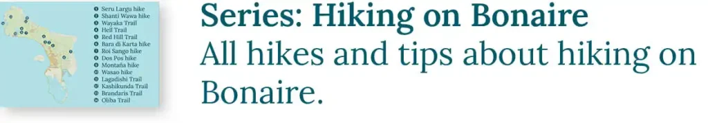
Onderwerpen
- 1 1000 Steps (1)
- 2 Love Bridge and Devil’s Mouth (2)
- 3 Plantation House Karpata (3)
- 4 Rei Willem-Alexander Marine Reserve (4)
- 5 Old Plantation Wall (5)
- 6 Lake Goto (6)
- 7 Dos Pos (7)
- 8 Rincon (8)
- 9 Mangazina di Rei (9)
- 10 The Rugged East Coast (10)
- 11 “Botanical Garden” and Tanki Maraka (11)
- 12 Seru Largu (12)
- 13 About Us: A Tour with HopiBonaire
- 14 Read more?
Get to know HopiBonaire for free. Download this blog as a PDF and let your phone guide you:

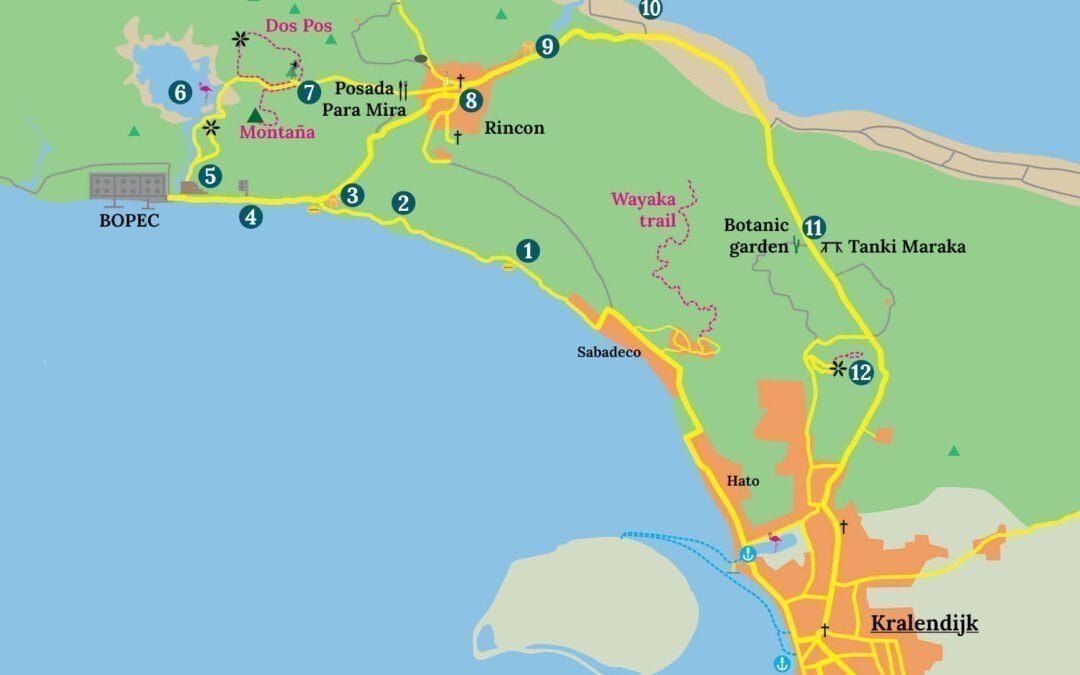
The scenic drive to the North starts when you leave the roundabout at the Marina and Chogogo Beach Resort in the northern direction. You drive through the Hato neighborhood to Sabadeco. Sabadeco is located on the coast. There are two popular snorkeling beaches: Andrea I and II. Sea turtles are often spotted here.
At the end of Sabadeco, past Santa Barbara Shores, the road makes a sharp turn towards the coast. Here, at dive sites Jeff Davis Memorial and Weber’s Joy, begins the Queen’s Highway. This beautiful winding road follows the west coast and is known for its stunning sea views and unique rock formations. Want to know more about the origin of these rock formations? You can read all about it in The Geology of Bonaire.
The Queen’s Highway was constructed in the 1960s with funds from the European Economic Community (EEC). Back then, the road was still referred to by its real name: the Tourist Road (Kaminda Turistiko in Papiamentu). The aim was to make the beautiful west coast and Gotomeer accessible to promote tourism, and it succeeded! The road to Seru Largu and the EEG Boulevard in the south were also part of this project. EEG in “EEG Boulevard” is Dutch for EEC.

1000 Steps (1)
Soon, you will arrive at the parking lots of one of Bonaire’s most famous beaches: 1000 Steps. The earlier you get here, the closer you can park to the stairs. It’s definitely worth taking a moment to look down from here, but we always start our northern drive with one of our favorite activities on Bonaire: snorkeling.
Our seven snorkeling commandments: • We use reef-friendly sunscreen. • We enter the water at the yellow entry/exit rock. • In the water, we stay horizontal: minimizing standing, and never stepping on corals. • We don’t touch anything. Even a light touch can harm the coral. • We don’t take anything out of the water unless it’s plastic waste. • We don’t feed the fish. • We respect the reef, so we pay our STINAPA Nature Fee. |
In the water at 1000 Steps, you can enjoy the beautiful coral gardens and the sea turtles that are often seen here. Once you’ve dried off and carried your belongings back up the stairs, you will understand why we call this place 1000 Steps. That’s exactly how it feels!

Love Bridge and Devil’s Mouth (2)
Just after 1000 Steps, the Queen’s Highway becomes a one-way road. After the dive site Tolo, the road curves away from the coast and a tall cliff comes into view. On the left-hand side, you can see a shallow cave: Devil’s Mouth. It appears straight ahead, just after the bend.

Just before the cliff, the road curves again. This is where you find the Love Bridge. Couples about to get married walk together beneath this natural arch, a tradition said to bind them together forever. If you look closely, you will spot the beginning of a narrow path winding its way along the rock wall.

Plantation House Karpata (3)
Plantation House Karpata, or Kas Grandi as this large house is also known, served as the residence of the plantation owner and the overseer of Plantation Karpata. This plantation was used for goat farming and the production of aloe oil, charcoal, and lime were produced. The lime kiln can still be admired in the parking lot. Plantation Karpata is named after another product produced here: castor oil. This versatile oil is pressed from the beans of the karpata, the castor tree. You can read more about the plantation era in The History of Bonaire.

The plantation house was thoroughly renovated in 1980. Unfortunately, after that, a sustainable purpose for the complex could not be found, resulting in it falling into decay once again. For those who haven’t had enough of snorkeling, there is another beautiful snorkeling spot located opposite the plantation house.
Rei Willem-Alexander Marine Reserve (4)
As mentioned before, the Queen’s Highway ends at the country house, but continue driving along the waters of the Rei Willem-Alexander Marine Reserve for a while longer. In this reserve, named after King (rei in Papiamentu) Willem-Alexander, entering the sea is prohibited. Commercial fishing is also not allowed. Stinapa, Bonaire’s nature organization, can observe how the reef develops when left undisturbed. This way, the impact of fishing and recreation on the heavily frequented dive sites can be better determined.
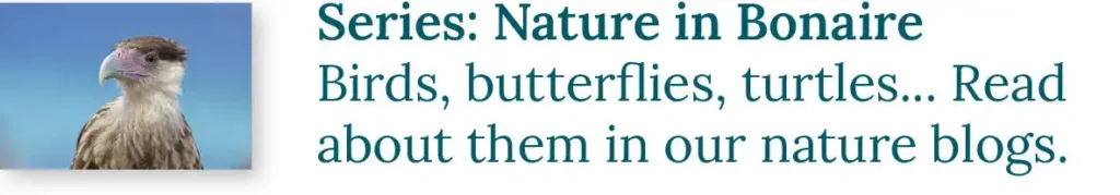
One regular visitor to this area is the osprey. If you don’t see it flying along the coastline, you might find it on the beach or perched on one of the poles equipped with cameras.

Old Plantation Wall (5)
At the end of the road stands an Traditional Stone Wall from Plantation Brasil. All plantations had to be fenced to keep the goats inside, as described in the purchase deeds drawn up in 1868. At that time, the Dutch Government offered its land for sale. After the abolition of slavery, they saw no viable way to continue profitable government-owned plantations. They decided to sell the land in pieces. As a result, the land came into the possession of family businesses, and plantations such as Washington, Slagbaai, and Karpata were established. Until the Second World War, these owners managed to make a profit, but afterward, the plantations fell into decay.
Behind the wall lies the BOPEC, the Bonaire Petroleum Corporation. The parent company, a Venezuelan oil company, used this terminal to send their oil in large oil tankers all over the world. However, the economic sanctions imposed by the U.S. President Trump on Venezuela in 2017 led to the bankruptcy of BOPEC in 2021. You can read more about it in our blog about Playa Frans. The route to this beautiful hidden gem in the north starts at this location.
Lake Goto (6)
By turning right before the wall, you will drive towards Lake Goto. Get ready for one of our other favorite activities on Bonaire: Bird watching! The water in this large saliña is brackish, although it becomes less salty during the rainy season compared to the dry season. Flamingos, herons and other water birds enjoy searching for food here. The lake is a RAMSAR site, a protected wetland of international importance.
First, on the right side of the road, you will come across a small parking lot with a beautiful view of this area. The owner of the Isla Falcon island below keeps goats and used to burn charcoal there. Continue on the road from here, which winds along the shores of the lake. During the rainy season, this road is sometimes flooded!

Dos Pos (7)
After the lake, you will continue on the narrow road further inland, heading towards Dos Pos. If you’re lucky, bird watching might not be over yet. Along this road, you will often spot Caracaras scavenging around. These impressive birds of prey are fond of roadkill, and many Lizards are killed by vehicles in this area.
About one and a half kilometers (one mile) from the lake, you will reach Dos Pos. This place gets its name from the two water wells (pos in Papiamentu) found here. Each well has a windmill that pumps groundwater. One windmill is located on the left side of the road, while the other one is behind the vegetation on the right side and cannot be visited. Before the residents of Rincon were connected to the water lines in 1962, their drinking water came from these wells.
Dos Pos is the heart of the habitat of the Lora Parrot. Look and listen carefully, as you might spot these unique birds nearby!

At Dos Pos, you find two beautiful hikes marked by pink stones. One trail leads up Montaña, offering stunning views of the west coast. The other, the Dos Pos Hike, is a circular route through the hills on the left side of the road. Avoid hiking during the hottest part of the day and bring plenty of water! Be sure to check out all our other Helpful hiking tips.
Text continues below…

Rincon (8)
Dos Pos is located in a valley. Further along, the road climbs again towards the next valley, where the Spaniards founded Rincon in 1527. This valley provided an ideal location for a settlement because there is always a cooling breeze, and the buildings are not visible from the sea. This was a significant advantage during the heyday of piracy!
Do not drive straight into Rincon’s valley just yet, because at the top of the hill, on the right side of the road, you find Posada Para Mira, a restaurant with refreshing drinks and a fantastic view. Here, you can enjoy lunch with traditional dishes like goat stew (kabritu stobá) with funchi and iguana soup (sòpi yuana) with plenty of bones.. On Sundays, there is often live music. You can also have lunch at Kos Bon So down in the village. After your well-deserved break, you can leisurely explore Rincon.

Rincon has preserved its charming village character. Besides the adorable colored houses, there’s a small supermarket, a church, a café, and… the Cadushy Distillery. This distillery is a haven for liquor, rum, and beverage enthusiasts. They are open from Monday to Saturday and warmly welcome visitors for tours.
Mangazina di Rei (9)
After leaving Rincon, you head back on the main road towards Kralendijk. At the end of the village, somewhat hidden on the left side of the road, you find a historical building: Mangazina di Rei. You won’t miss the large parking lot.

In 1636, the Dutch West India Company (WIC) conquered Bonaire from the Spanish. After the company’s bankruptcy in 1791, Bonaire became the possession of the Dutch government. Little changed for the enslaved workers who had to toil in the salt pans and on the land. Under the rule of the king (the head of the government), they were still subjected to heavy and unpaid labor, and a cruel and inhumane treatment.
The yields were brought to this building. Mangazina di Rei translates to Warehouse of the King. Here, the so called government slaves could collect their weekly rations, which consisted of some corn, pickled meat, coffee and rum. Fortunately, their families grew some additional food near their hut in Rincon.
If the enslaved workers were assigned to work in the salt pans in the south, they had to walk all the way to this place during the weekends! You can read more about slavery in The History of Bonaire.
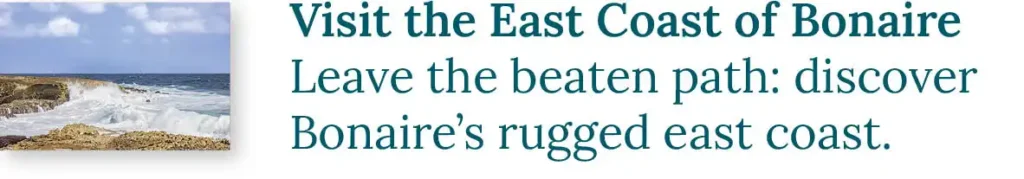
The Rugged East Coast (10)
After Mangazina di Rei, the road makes a sharp bend towards the southeast. After about a kilometer (a mile), you will come across a wide sandy road on the left side of the main road, leading to the East Coast. You can already see the sea from here. If the condition of the road permits, you can drive on it for a short distance. The last 150 meters (500 feet) towards the coast are best covered on foot.
The east side of Bonaire is particularly rugged. The waves crash forcefully against the cliffs, and due to the salty mist, there is very little vegetation in these plains. Further along, you find, among other things The Onima indian drawings and Boka Onima. In our tour The Magical North we explore this beautiful area extensively.

“Botanical Garden” and Tanki Maraka (11)
Continue along the road toward Kralendijk. For nature lovers, we like to mention Bonaire’s “Botanical Garden,” which you find on the right-hand side about seven kilometers (4.5 miles) past Mangazina di Rei. The owner, Manuel Sabana, a traditional healer, is happy to show you around his remarkable garden and loves to share stories about the plants he grows and the healing powers he attributes to them.
Those interested in local events during World War II can stop a little further down the road on the left, at the open-air exhibition Tanki Maraka.
During World War II, the Tanki Maraka site was home to a U.S. Army camp. Today, only the concrete foundations remain. The radar installation that once stood here was intended to protect the strategically important oil refineries on Curaçao and Aruba. These refineries were vital to the Allied war effort.
Although the Germans never managed to hit the refineries directly, their submarines frequently succeeded in torpedoing departing oil tankers. Many Bonairean crew members lost their lives in these attacks. They are commemorated at the war memorial on Plaza Wilhelmina in Kralendijk.

Seru Largu (12)
A kilometer and a half (one mile) down the road, you see a large field on your right. Until World War II, this was Felt di Snip, Bonaire’s airstrip. In 1943, the Americans built a new airport south of Kralendijk.
At the end of the field, turn right onto the paved road. Follow it uphill and turn left at the top to join the ring road heading toward Seru Largu.
At the top of the hill, you find the Millennium Monument, also known as Cruz Seru Largu. This Catholic monument was built in the year 2000. On the column are the words Kristu – ayera, awe, semper, meaning: Christ – in the past, today, and forever. At the bottom, you see a large letter M, referring to the shrine of Mary that once stood here.
Most visitors come here to enjoy the sweeping views over Kralendijk and the South of Bonaire, but the hill is also a favorite workout route for local walkers. At the top, you also find a well-marked and accessible walking trail. The Seru Largu Hike takes you past even more stunning vistas.

The sun will probably be low in the sky by now, and this is the perfect spot to witness a stunning sunset. On a clear day, you can even see Curaçao from here. We hope there’s still a cold drink in the cooler!

Get to know HopiBonaire for free. Download this blog as a PDF and let your phone guide you:
Looking for activities on Bonaire? The scenic drives are an absolute must-do! The information above is just a fraction of what there is to discover along the northern drive. If you want to know more, we are happy to take you on a tour. During our The Magical North Tour, we also explore the beautiful off-road trails of the North.
Are you also interested in exploring the Southern Salt Pans of Bonaire? Read our Scenic drive to the Salt Pans of Bonaire blog. Just like this drive, you drive it with your own rental car, scooter, or golf cart.
About Us: A Tour with HopiBonaire
Embark on a discovery journey to the most remote and beautiful spots on the island with HopiBonaire. Travel exclusively with your own group, ensuring an intimate and personalized experience at your own pace. No rushing here!
Discover other exceptional snorkeling spots with fully personalized tours that can be customized to your preferences. Explore our tours and get excited to join the adventure!
Read more?